
Work / Building and access flood-risk intelligence
Building and access flood-risk intelligence
Building and road-access risk mapped for real-asset owners, so portfolio exposure is visible before an event and actionable at asset level.
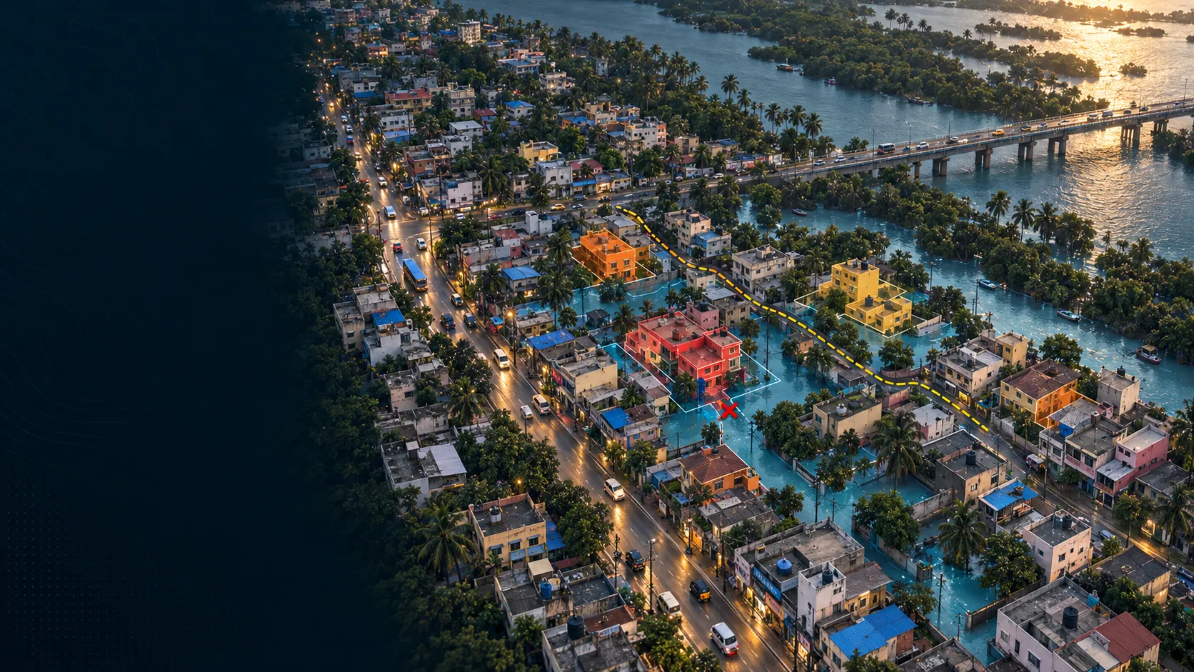
A closer view of the spatial output.
Project visuals are anonymised and framed around the decision they support.

Context and objective
A climate-risk technology platform needed flood intelligence that a building owner or portfolio manager could act on, not another regional hazard layer.
The objective was to connect flood exposure with the road access that determines whether an affected property can still be reached and used.
Delivered intelligence
- Building-level flood-risk classes
- Road-access risk connected to the assets it serves
- Portfolio-ready spatial layers and thematic maps
- Dashboard and report views for asset decisions
Outcome
The delivery makes two related questions visible together: whether an asset is exposed, and whether the routes serving it remain usable. Teams can screen a portfolio, identify priority assets and move from a broad hazard view to an operational decision.
Practical value and scalable use
The delivery supports property screening, portfolio prioritisation and resilience planning across riverine and coastal settings. The public view retains the relationship between buildings and roads while removing place, client, project and scenario identifiers.
All deliverables are produced and quality-assured to industry standards and have been accepted by our clients.
Bring us the decision. We will shape the spatial intelligence around it.
Start with a focused conversation about the outcome, the users and the evidence already available.